The rebirth of AlUla
Hegra, ancient city of the Nabataeans in Saudi Arabia’s historic AlUla Valley, is emerging from the mists of time to take its rightful place as one of the wonders of the world

Few have been privileged to visit the ancient city of Hegra, hewn from the rocks of the Hijaz in northwestern Saudi Arabia two millennia ago and lost for centuries in the mists of time.
Now, as the new Saudi Arabia increasingly opens its doors to the outside world, the Kingdom is poised to share with that world one of the great forgotten treasures of antiquity.
Like its famous northern twin, Petra, Hegra was created by the Nabataeans, a mysterious people whose Arabian empire of trade flared briefly but brightly more than 2,000 years ago.
The unveiling of the spectacular rock-cut tombs of the ancient city, after more than a decade of one of the most intensive archaeological investigations ever undertaken, is part of an initiative to transform the dramatic landscape and heritage of the wider AlUla region into one of the world’s greatest cultural tourism destinations.
In 2020, the archaeological sites of Hegra will be reopened to the public, which got its first glimpse in many years through last year’s first Winter at Tantora festival, a spectacular celebration of art, music and heritage that will draw the world once again to AlUla from Dec. 19 to March 7.
The opening up of Hegra and the AlUla Valley, in antiquity a vital artery of trade and a cultural melting pot, restores a missing chapter in the history of the region and the entire world, bringing full circle a tale that, until now, has been only half told.
Hegra: An ancient city lost in time


In the 1870s the British explorer Charles Montagu Doughty found his way to Hegra by joining 'the great Damascus caravan' of pilgrims heading for Makkah.
In the 1870s the British explorer Charles Montagu Doughty found his way to Hegra by joining 'the great Damascus caravan' of pilgrims heading for Makkah.


A now-headless eagle guards the entrance to a tomb cut into Qasr Al-Bint, a massif northeast of Hegra city wall used since the early first century as the site of a necropolis. The bird may represent the Nabataean deity Dushara.
A now-headless eagle guards the entrance to a tomb cut into Qasr Al-Bint, a massif northeast of Hegra city wall used since the early first century as the site of a necropolis. The bird may represent the Nabataean deity Dushara.
It was among the “vast mountainous labyrinthine solitude of rainless valleys” of the Sinai that the 19th-century British explorer Charles Montagu Doughty first saw them.
Written in a long-dead language, the mysterious and “often strangely scribbled” inscriptions on the “sand-wind burnished rocks and stones” meant nothing to him.
Doughty, a poet, fancied he might be gazing upon “the names ... and salutations of ancient wayfarers.” As archaeologists would demonstrate decades after his death, he was absolutely right.
He had found the marks of the Nabataeans, a people lost in the mists of antiquity, carved into the rocks more than 2,000 years earlier as they had travelled the trading routes of the ancient world.
Amr Al-Madani, the CEO of the Royal Commission for AlUla, speaks about AlUla as an ancient crossroads, while Ahmad “Mr. AlUla” Al-Imam and a local storyteller show us two of the old cities.
Petra in modern-day Jordan, the “rose-red city half as old as time” as it would be immortalized by a British poet in 1845, was already well known in the West, having been “discovered” in 1812 by Johann Burckhardt, a Swiss traveler.
But in 1877, in the shadow of the Hijaz Mountains Doughty was to stumble upon a lost city of the dead, rich with rock-carved tombs and monuments, wholly unknown in the West.
In his book “Travels in Arabia Deserta,” published in 1888, Doughty recalled that at the settlement of Ma’an, some 30 km southeast of Petra, he heard of “other Petra-like sculptured cliff-monuments, bearing many inscriptions,” at a distant place called Mada’in Salih.
This, he learnt, was a lonely water-station “of the Damascus yearly pilgrims’ caravan, in their long desert way to Madinah and Makkah; lying some few days’ journey southward from Ma’an, but difficult to be reached, at other times, for danger of the wild Bedouins.”
Undeterred, Doughty “resolved to accept the hazard” of visiting the monuments at Mada’in Salih. For protection, he joined “the great Damascus caravan,” travelling in the company of the faithful, bound south along the old pilgrim trail for Makkah and finally arrived at Mada’in Salih “after three weeks’ tedious riding."
There, Doughty discovered evidence of a settlement that had clearly thrived in antiquity, but which had been all but swallowed by time and sand – the ancient city of Hegra. Like Petra, it had been built by the Nabataeans, a people who, from about the fourth century B.C. until the Roman invasion of Arabia in A.D. 106, had controlled the profitable trade routes that crossed the Arabian Peninsula from east to west and north to south, creating a vast desert kingdom.
Surrounding the “old ruinous sand-plain” where a people had once thrived, Doughty found spectacular tombs, “full of men’s bones,” hewn out of the towering sandstone outcrops that overlooked the site of the old city.
Doughty lingered at the site for two whole months, awaiting the return of the pilgrimage caravan, visiting the monuments and carefully recording many of the ancient inscriptions on the site.
A now-headless eagle guards the entrance to a tomb cut into Qasr Al-Bint, a massif northeast of Hegra city wall used since the early first century as the site of a necropolis. The bird may represent the Nabataean deity Dushara.
For Hegra, which for the past decade has been the subject of one of the most exhaustive archaeological investigations ever mounted, Doughty's discovery was the beginning of a long journey back into the limelight from the obscurity of antiquity.
As for the Nabataeans, however, mystery continues to surround the origins of a people who for 400 years commanded a vast kingdom that in size and scope foreshadowed that of Saudi Arabia – and whose written language was one of the final steppingstones in the evolution of Arabic.
“The history of the Nabataeans before 311 B.C. remains a mystery because of a lack of sources,” said Robert Wenning of the University of Munster’s Institute for Ancient Near Eastern Studies. “They are not mentioned in any source before that date.”
Wenning’s research has led him to conclude that, wherever the Nabataeans came from, they had become involved in the valuable trade in incense and aromatics by about 380 B.C. Growing wealthy, by 311 B.C. they had become a target for powerful forces.
“Little remains of the old civil generations of El-Hejr (Hegra), the caravan city; her clay-built streets are again the blown dust in the wilderness. Their story is written for us only in the crabbed scrawlings upon many a wild crag of this sinister neighborhood, and in the engraved titles of their funeral monuments, now solitary rocks, which the fearful passenger admires, in these desolate mountains ...”
From “Travels in Arabia Deserta” by British poet and explorer Charles Montagu Doughty, published in 1888


The earliest known historical reference to the Nabataeans was written by Hieronymus of Cardia, a Greek general who took part in a series of failed attempts to best them. His original account, written in about 311 B.C., no longer exists, but was quoted at length by Diodorus of Sicily, an historian whose ‘“Bibliotheca Historica” was written between 60 and 30 B.C.
When encountered by Hieronymus in the third century B.C., the Nabataeans were still nomads. “They live in the open air,” he wrote, “claiming as native land a wilderness that has neither rivers nor abundant springs from which it is possible for a hostile army to obtain water.”
But it was clear that they had already found their true calling. “While there are many Arab tribes who use the desert as pasture,” wrote Diodorus, “the Nabataeans far surpass the others in wealth ... for not a few of them are accustomed to bring down to the sea frankincense and myrrh and the most valuable kinds of spices, which they procure from those who convey them from what is called Arabia Eudaemon,” (the southern part of the Arabian Peninsula).

From Hieronymus, who in A.D. 311 took up arms against the Nabataeans in the service of the Macedonian general Antigonus, intent on helping himself to some of their wealth, we know via Diodorus that these deceptively humble traders were no pushover.
Antigonus dispatched an expeditionary force of 4,000 foot-soldiers and 600 horsemen under his general Athenaeus, “and ordered him to set upon the barbarians suddenly and cut off all their cattle as booty.”
Athenaeus knew that many of the Nabataeans had gathered for an annual market, leaving their possessions and families behind for safety on “a certain rock ... exceedingly strong but unwalled.” This, historians believe, may have been Petra, thought to have been the capital of the Nabataeans from as early as the fourth century B.C.
Athenaeus fell upon the defenseless Nabataeans, some of whom “he slew at once, some he took as prisoners, and others who were wounded he left behind; and of the frankincense and myrrh he gathered together the larger part, and about 500 talents of silver.”
Athenaeus fled the scene but some of his captives escaped and led back a Nabataean force of 8,000 warriors, who attacked the camp in the early hours of the morning. Barely 50 men escaped the ensuing massacre.
Furious, Antigonus sent another force of 8,000 men to avenge the first. This time the Nabataeans were ready for them on the high ground of the rock and the Greeks suffered another defeat. In a final attempt to take some profit from his incursion into the land of the Nabataeans, Antigonus sent a third force under Hieronymus, the writer of the history of the campaign, to gather up the valuable bitumen found floating on the surface of the Dead Sea.
The result “was not in accord with the expectations of Antigonus; for the Arabs, collecting to the number of 6,000 and sailing up on their rafts of reeds against those on the boats, killed almost all of them with their arrows.”
At this point Antigonus cut his losses.
Much changed for the Nabataeans in the three centuries between Hieronymus of Cardia’s observations and their next appearance in written history, in an account by Strabo, a Greek geographer and historian from Amasya (in modern-day Turkey) who traveled widely in the last years of the first century B.C.
In his book “Geographica,” believed to have been written between 7 B.C. and A.D. 18, Strabo offered a tantalizing snapshot of a people who, by now at the height of their domination of the trans-Arabian trade routes, had given up the travelling life and lived well – and, for the times, curiously democratically.
It is unclear exactly where Strabo encountered the Nabataeans – by this time in their history their influence covered a vast area, extending from Damascus in the north to Gaza on the Mediterranean coast and the Sinai Peninsula in the west, and from the shores of the Red Sea across half of modern-day Saudi Arabia toward the east. Their southernmost limit is thought to have been somewhere south of Hegra.
Wherever he came across them, however, he knew them well enough to note with some surprise that, despite their obvious wealth, they had few slaves, and “are served by their kinsfolk for the most part, or by one another or by themselves” – an unusual custom for the time which, reported Strabo, “extends even to their kings.”
One part of Strabo’s account suggests that, while he may have visited the Nabataeans at Petra, he did not find his way to its sister city, Hegra, some 500 km to the south. Praising the homes of the Nabataeans – which, “through the use of stone, are costly” – he noted that “on account of peace, the cities are not walled.” As a decade of excavation at Hegra has proved beyond doubt, the Nabataeans’ southernmost city was most definitely surrounded by strong ramparts, parts of which have been dated to the mid- to second half of the first century, while one of the ancient gates was probably built during the late first century B.C.
Although most of the tombs at Hegra were carved and used between the first and early fourth centuries, occupation of the site dates from about the fourth century B.C. There is growing evidence that the Nabataean presence at Hegra continued in some form well into the fourth century, but their grip on the region and the profitable trade routes was ended in A.D. 106, when the whole of their territory was overrun by the legions of the emperor Trajan, and subsumed into the Roman province of Arabia Petraea.
For decades, there was no evidence to suggest that Rome’s influence in Arabia had extended much farther south than the mouth of the Gulf of Aqaba on the Red Sea. But the discovery of a fortified Roman camp on the southern boundary of the ancient city is just part of the astonishing story that has emerged over the past decades, thanks to the work of a joint Saudi-French archaeological team whose trowels have swept away the sands of time that had obscured the world heritage treasure that is Hegra for two millennia.


AlUla: An archaeologist's fantasy
Snaking over more than 30 kilometers between the ancient cities of Hegra and Qurh, the AlUla Valley is yielding a wealth of archaeological treasures that together tell the story of Arabia from prehistoric times to the earliest days of the post-Islamic era


The tombs of the Nabataeans at Hegra were carved out of the sandstone outcrops that surround the site of the ancient city.
The tombs of the Nabataeans at Hegra were carved out of the sandstone outcrops that surround the site of the ancient city.
Perhaps unsurprisingly for an archaeologist, Laila Nehme, a faculty member of France’s prestigious National Center for Scientific Research and co-director of the Hegra archaeological project since 2008, has never been much of a fan of the fantasy TV series “Game of Thrones.”
Real history, she finds – especially the history that she and her multinational, multidisciplinary team have been unearthing in the AlUla Valley for the past decade – is far more amazing than fiction.
A little while ago, however, she read an article in the French newspaper Le Monde about “Game of Thrones” and its mythical land of Westeros, bordered to the north by a wall of ice raised to keep out the dreaded supernatural hordes of White Walkers, and it made her think about one of the many discoveries made by her and her team at Hegra.
“The article drew parallels with Hadrian’s Wall in the north of England, built by the Romans to keep out the barbarians to the north – the ‘White Walkers’ that threatened the empire,” she said.
The tombs of the Nabataeans at Hegra were carved out of the sandstone outcrops that surround the site of the ancient city.
The wall, built on the orders of the Emperor Hadrian between A.D. 112 and 118, marked the northwestern limit of the Roman Empire. More than 4,000 km to the south, the Hegra archaeologists made a discovery that redrew the map of that empire – the remains of a legion’s fortified camp that proved beyond doubt that the southern limit of the Roman province of Arabia Petraea was farther south than anyone had previously known.
“So, if Hadrian’s Wall in the cold climate of northern Britain was the Romans’ ice wall,” Nehme said, “what we have found here at Hegra in the heat of Arabia is the empire’s fire wall.”
Few people know as much about ancient Hegra and the Nabataeans as Nehme. Now 53, she first came to Syria on the trail of the Nabataeans when she was 19, as an archaeology student specializing in epigraphy, the interpretation of ancient inscriptions, and in 1994 she wrote her doctoral thesis on Petra.
In 2001 Nehme and Dhaifallah Al-Talhi, an archaeologist from the University of Hail, were appointed co-directors of the Mada’in Salih Archaeological Project. Between 2002 and 2005 a team of French archaeologists, working in collaboration with the Saudi Commission for Tourism and Antiquities, carried out the first comprehensive survey of the site of Hegra, which lay the groundwork for the methodical archaeological exploration of the site that began in 2008 and has continued ever since.
Amr Al-Madani, the CEO of the Royal Commission for AlUla, talks about the role of archaeologists in making AlUla a 'living museum.'
The survey also informed Saudi’s successful application in 2007 to have Hegra listed as a UNESCO World Heritage Site – the first to be inscribed in the country.
In 2018 the archaeological collaboration between France and Saudi Arabia at Hegra led to the creation of the French agency, Afalula, which has been founded to support Saudi Arabia in the economic, touristic and cultural development of the AlUla region, in which Hegra sits.


A survey of the entire 22,000 sq km AlUla region has already identified over 23,000 sites of archaeological interest.
A survey of the entire 22,000 sq km AlUla region has already identified over 23,000 sites of archaeological interest.


A bronze figurine of a goat was found only five centimeters below the soil in a room in the fortified Roman camp unearthed in the southeast of the ancient city of Hegra.
A bronze figurine of a goat was found only five centimeters below the soil in a room in the fortified Roman camp unearthed in the southeast of the ancient city of Hegra.

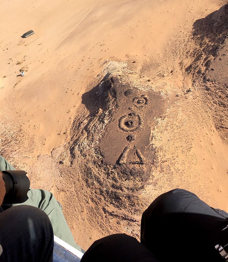
A view of an ancient site in the hinterland of AlUla being photographed from a helicopter by the survey team.
A view of an ancient site in the hinterland of AlUla being photographed from a helicopter by the survey team.


A large amount of pottery has been found at Hegra, ranging from small fragments to whole jars, and dated from the pre-Nabataean era to the Roman occupation in the early second century and beyond. Some pieces were made locally, but others were imported from around the Mediterranean and Mesopotamia, reflecting Hegra’s key role in the trans-Arabian caravan routes.
A large amount of pottery has been found at Hegra, ranging from small fragments to whole jars, and dated from the pre-Nabataean era to the Roman occupation in the early second century and beyond. Some pieces were made locally, but others were imported from around the Mediterranean and Mesopotamia, reflecting Hegra’s key role in the trans-Arabian caravan routes.

One part of the survey team is concentrating on recording all sites of interest in the oasis that runs for much of the length of the valley.
One part of the survey team is concentrating on recording all sites of interest in the oasis that runs for much of the length of the valley.
Some 200 km inland from the Red Sea, Hegra is situated on a large plain southeast of the Hijaz Mountains, studded with hills of sandstone, isolated or grouped together to form massifs that have been dramatically sculpted by the northwesterly winds that have blown through the region every spring and early summer since the dawn of time. The largest is Jabal Ithlib, in the northeast of the site, which towers almost 100 meters above the plain.
The winds have also created strange and evocative shapes, such as the three-storey rock 10 km northeast of the modern town of AlUla, sculpted over millions of years to resemble an elephant.
In the center of the site, once served by the 130 wells driven into the rock that made possible the sprawling oasis that once supported the ancient city, is the residential area. Although very little remains above the surface of buildings that were made in antiquity largely from mudbricks, geophysical surveys between 2002 and 2005 revealed tantalizing evidence of underground structures, while parts of the city wall could still be seen with the naked eye.
Without doubt the stars of Hegra highlighted in the UNESCO nomination were the necropoles that surround the residential area – cities of the dead, featuring more than 90 monumental tombs carved out of the rocks surrounding and overlooking the city of the living, and dating from about 1 B.C. to A.D. 75.
Of the four main necropoles, Qasr Al-Bint, home to 31 tombs dated from the year nought to A.D. 58, is the most visually dramatic – both from a distance and up close. The exterior facades of many of the tombs feature carved monsters, eagles, other small sculpted animals and human faces.
A survey of the entire 22,000 sq km AlUla region has already identified over 23,000 sites of archaeological interest.
As at Petra, many of the tombs feature spectacular carved facades. However, unlike at Petra many of the facades carry dated Nabataean inscriptions, in many cases naming the dead and offering a unique insight into the lives of the people who once called Hegra home.
For Nehme, one of the most interesting things about the Nabataeans is the variety of architectural influences apparent in the tombs they carved, which borrowed motifs from Greek, Egyptian, Phoenician, Roman and Mesopotamian architecture.
“The Nabataeans were like a sponge, absorbing things from their surroundings and creating something that is completely theirs, such as the architecture,” she said. “The result is something that you see nowhere else, and it’s the same with their pottery, their writing and their religion.”
This cultural crossover attests to just how widely travelled the Nabataeans were as they went about the profitable business of managing and controlling the trade routes of ancient Arabia.
“They were travelers,” added Nehme. “Independent for about 400 years, until the early second century, they came into contact with the Romans, and with the Greeks before that, saw what they were doing and copied them.”
The excavation since 2008 of several of Hegra’s monumental tombs, which has yielded a large quantity of human bones, leather and textiles, has allowed the archaeologists to piece together Nabataean funerary rituals, from the death of an individual to their burial.
One tomb in particular, designated IGN 117 by the archaeologists, has given up many secrets. Above the door was a carved tablet, dated to A.D. 60 or 61, that read: “This is the tomb which Hinat daughter of Wahbu made for herself and for her children and her descendants for ever. And no-one has the right to sell it or give it in pledge or write for this tomb a lease. And whoever does other than this, his share will revert to his legitimate heir. In the twenty-first year of King Maliku, King of the Nabataeans.”
Under the sand that covered the floor of Hinat’s tomb archaeologists discovered the remains of no fewer than 80 individuals, adults and children, who had been buried there between the first and the third centuries.
A bronze figurine of a goat was found only five centimeters below the soil in a room in the fortified Roman camp unearthed in the southeast of the ancient city of Hegra.
One poignant and unexpected find, discovered among the folds of material wrapped around the skull of one of the women in the tomb, was the remains of a necklace of dates on a string of twisted palm-tree leaves – a gift for the journey to the afterlife and a practice unique to Hegra and the Arabian Peninsula.
In a paper published in 2015 the archaeologists recorded that, hauntingly, in the contours of the folds in the fabric and leather wrapped around the skull, “the negative of a face can be discerned, along with the presence of some strands of hair.”
This and other explored tombs may help to solve the mystery of the origins of the Nabataeans. DNA analysis of bone samples taken from 40 individuals is now underway at Harvard Medical School as part of a project studying the ancient DNA of Arabia.
Hegra did not, of course, stand alone. The range of languages in the many inscriptions found during an exhaustive survey of the Darb Al-Bakrah, the old camel trading route that ran between Hegra and Petra, bears witness to the multicultural nature of the ancient spice trade and to the ebb and flow of different nationalities that passed that way, leaving their mark not only on the rocks but also on the ancient history of Saudi Arabia.
The scripts and languages left for posterity along the way include Imperial Aramaic, adopted by the Persians in about 500 B.C. as the language of officialdom following their conquest of Mesopotamia and beyond, Greek, Palmyrene, Taymanitic, Dadanitic, Hismaic, Safaitic, Nabataean and Nabataeo-Arabic – a transitional language that eventually evolved into Arabic.
In 2004, Nehme and a team of seven Saudis spent three days retracing the route first identified in 1999 by Saudi archaeologist Dr Ali Al-Ghabban. Sleeping in the desert, taking hundreds of photographs and recording more than 900 inscriptions, they followed the 300-km trail from just north of the modern-day city of AlUla to the border with Jordan. From there, the ancient travelers would have faced a further 150-km journey before reaching Petra, the northern sister city to Hegra.
In 2018 a complete catalogue of the inscriptions was published as “The Darb Al-Bakrah – A Caravan Route in North-West Arabia,” a weighty book of more than 300 pages edited by Nehme. Along the way, she said, she came to know the ancient Nabataeans intimately.
“I was following in the footsteps of people from antiquity, and at times I found myself following the same person in different places,” she recalled. “At one place and then 30 km further on, the same man would write his name again. I even found a place where one man’s name appeared twice, seven years apart in dated inscriptions from the early Roman period.”
Some of inscriptions along the length of the trail from Hegra to the Jordanian border are nothing more than names – an ancient “I was here” – but others offer tantalizing glimpses of another age. Some names are accompanied by the phrase “may be safe,” others urge that the traveler “may be remembered,” while one, suggesting something of the dangerous times in which it was written, expresses the hope, “may any man who went to Ḥegra and any camel be safe.” Another writer records the ghostly presence of his “companions the cavalrymen in charge of the guard.”
Some individuals, unwittingly securing for themselves a kind of immortality, left a record of their profession. The signatories included military men, servants, scribes, farmers, camel breeders, a priest and an embalmer – perhaps on his way to prepare the dead for burial in the rock tombs at Hegra.
As spectacular as the rock-carved tombs of Hegra are, the past 17 years of exhaustive archaeological investigation of the approximately 30-square-kilometer site has been the prelude to a breathtakingly ambitious archaeological survey of the entire AlUla region – not only of the oasis valley to the south of the ancient city but also of the surrounding area of more than 22,000 square kilometers.
This is the task that has been taken on by American archaeologist Dr. Rebecca Foote, who in late 2017 was appointed director of archaeology and cultural heritage preservation at the newly formed Royal Commission for AlUla (RCU).
A view of an ancient site in the hinterland of AlUla being photographed from a helicopter by the survey team.
“There hadn’t been a comprehensive archaeological survey of AlUla county, not even of the central oasis valley, though much had been registered there,” she told Arab News. “So, my first job was to find out what we have – to protect in the face of the imminent development, to potentially activate for tourism and to identify what is there for future in-depth scholarly research.”
From the outset, she realized that she and the survey teams of initially 20 people, and now more than 40, faced a huge task. “What’s particularly remarkable about this survey is the sheer scale of it. To be covering an entire county about the size of Sardinia in just two or three years is unusual and challenging.”
To make it manageable, they divided the vast search area into three separate zones, each of which would be approached slightly differently and tackled by different teams. By far the largest was the area designated the “hinterland,” more than 19,000 square kilometers of rugged terrain stretching from the peaks of the Hijaz Mountains in the west to the deserts in the east.
The next largest site was the central “core” area of about 3,300 square kilometers. Within the core lies a 48-square-kilometer strip of ancient oasis that snakes approximately 30 km from the ancient Dadanite city of Qurh (modern-day Al-Mabiyat) to just south of Hegra. The detailed survey of this area began in October. The abandoned settlement known as the Old Town of AlUla, 17 km south of Hegra, is also being examined separately.
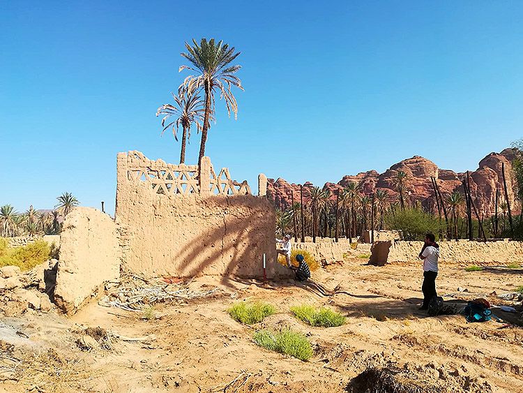
Occupied until the 1980s, when the occupants abandoned the town for the creature comforts of the newly built modern-day AlUla, a few kilometers to the south, the old ghost town is an intriguing part of the area’s heritage and will doubtless prove a draw for tourists.
“The focus of what we’re doing right now is recording the buildings in detail and stabilizing them to prevent further collapse,” added Foote. “Decisions will be made about how it will figure in the ultimate reinvigoration of the area by the stakeholders and master-planning.”
As to how old it is, “that’s what we’re trying to figure out at the moment. We know from Ibn Battuta, for example, who wrote in the early 14th century that it was then a ‘big village,’ but it is certainly older. The date of earliest occupation is what we’re hoping to find out from targeted excavation.”
Although centuries of repairs make it difficult to assess, it is possible that some of the walls that are still standing could date back at least 800 years.
Originally well-built out of mudbricks on stone foundations, the houses were small – most are one large room on each floor – and packed together. For generations, said Foote, “every family there would have had a farm in the oasis. They’d have lived in the Old Town in the winter and on their farm in the summer.”
It is not just the physical size of the project that Foote and her team are undertaking that is impressive. The timeline they are examining extends from pre-history right up to World War I – for the simple reason that the 1,300-km Hijaz Railway, built by the Ottomans and opened in 1908 to speed the journeys of pilgrims from Damascus to Madinah, runs through the AlUla Valley.


One of the original locomotives on the Damascus-to-Madinah Hijaz Railway line, abandoned after World War I. Many of the station buildings close to the site of ancient Hegra have been preserved.
One of the original locomotives on the Damascus-to-Madinah Hijaz Railway line, abandoned after World War I. Many of the station buildings close to the site of ancient Hegra have been preserved.
With such a vast and disparate area to survey, Foote’s teams have drawn on the very latest archaeological techniques, utilising satellite images, drones used to conduct photogrammetric surveys, in which photographs are captured from multiple angles and transformed by software into 3-D images, and aerial laser scans – a technique known as LIDAR, light detection and ranging, that enables ground features to be “seen” through foliage. Together with high-resolution orthophotography, these techniques identify any sites that appear to be the product of human activity more than 100 years old.
The survey began in the spring of 2018. As an indication of the wealth of material that is out there, after just two years it has identified an astonishing 23,000 sites, many of which have more than one item of interest.
A large amount of pottery has been found at Hegra, ranging from small fragments to whole jars, and dated from the pre-Nabataean era to the Roman occupation in the early second century and beyond. Some pieces were made locally, but others were imported from around the Mediterranean and Mesopotamia, reflecting Hegra’s key role in the trans-Arabian caravan routes.
In the core area, by far the biggest category of finds is categorised as “artistic/communication” – rock art and inscriptions. So far, the team has identified inscriptions in nine different languages, whose use spans millennia: Thamudic, Aramaic, Dadanitic, Minaean, Nabataean, Greek, Latin, Hebrew and Arabic.
All the finds are being logged in a specially designed database, developed by the University of Oxford. “Our focus is to get it all recorded accurately in the database,” added Foote. Designed primarily as a heritage management tool for the RCU, the database will also be shared with academics hoping to carry out research projects in the area.
One of the intriguing mysteries the survey team hopes to solve is why, unlike in other parts of the Middle East, settlement in the AlUla Valley was not consistent.
“There are four main settlements that we know of so far,” said Foote. “Settlement begins at Dadan, which is in the center of the valley, then it moves up to Hegra. Then it goes down to Qurh and then it comes back up to what’s called Old Town today, which was inhabited until the 1980s. Why is it that we are seeing that pattern of settlement in this valley, rather than one primary settlement site?”
The answer, which may yet emerge from the soil, could be related to war, politics, religion or even a catastrophic earthquake, which may have contributed to the destruction of ancient Dadan.
The city of Qurh flourished from the sixth century, the eve of the Islamic era, until the 12th. Its occupation overlapped with that of Al-Dirah, AlUla’s Old Town, which was occupied from about the 10th century until its abandonment in the 20th century. In their time, both were flourishing communities that welcomed pilgrims travelling to and from Makkah and Madinah.
One part of the survey team is concentrating on recording all sites of interest in the oasis that runs for much of the length of the valley.
The other puzzle waiting to be solved is the relationship between the Lihyanites, the tribe that predated the Nabataeans and ruled Dadan, and the Nabataeans themselves. Inscriptions tells us that the language of each, while similar, was different.
Between at least 600 and 200 B.C., “Dadan was a major flourishing city, the capital of the Dadanite and Lihyanite kingdoms, and they were making money on the incense trade and controlling it long before the Nabataeans,” added Foote. “It’s unclear exactly what the relationship between them was, and why the 15 km shift from Dadan to Hegra happened."
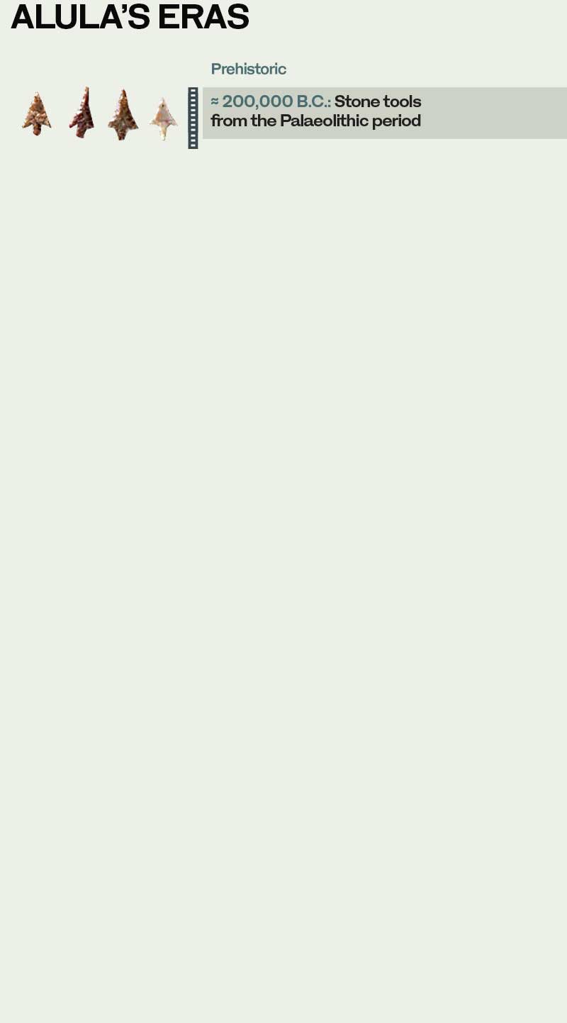
Two years into the great survey, the true depths of AlUla’s historic roots are already becoming apparent. Although a few stone tools that date back to the stone age – between 150,000 and 200,000 B.C. – have been recovered, the handful of sites that have been excavated so far have been dated to between 2,000 and 5,200 B.C.
The material used for radiocarbon dating the oldest of these sites to about 5,200 years B.C. offers a poignant reminder of the everyday lives of the people who once lived in the land that, more than 7,000 years later, would become Saudi Arabia – charcoal from a hearth, and two animal teeth, possibly from a sheep or a goat.
“Most everyone who comes here will want to see the World Heritage Site of Hegra,” said Foote. “But we want everyone who comes to AlUla to know the larger context of this area. There is so much more, both in a natural and a cultural sense, that will make this place a major destination.”
Part of that is the ancient city of Dadan (modern-day Al-Khuraybah), even older than Hegra and barely 20 km away down the AlUla Valley. Dadan has been the subject of excavations by King Saud University in Riyadh for more 15 years, but now an enhanced archaeological program at the site, with principal investigators from the French National Center for Scientific Research and the RCU, is due to begin in February.
The co-director of the ambitious five-year program is Abdulrahman Al-Suhaibani, a 34-year-old assistant professor of archaeology at King Saud University and a heritage consultant to the RCU.
Dadan, a city that predated Nabataean Hegra and thrived in the AlUla Valley from at least 600 to 200 B.C., before mysteriously disappearing from history, has long been a puzzle – and one that Al-Suhaibani and his colleagues are determined to solve.
“One of the most important questions is about the origins of the Nabataeans and the relationship between the Dadanites and the Nabataeans,” said Al-Suhaibani, who obtained his Ph.D. on the architecture of Dadan at the Sorbonne in Paris.
The Nabataean civilization was preceded by the kingdoms of Dadan and Lihyan, but the extent to which these peoples overlapped is unclear. “We know the Nabataeans came from Petra to Hegra around the second half of the third century B.C. So, the question now is, what is the relationship between the end of the Lihyanites and the coming of the Nabataeans in this region?”
So far, archaeologists have been long on speculation, but short on facts. “Is it, perhaps, that the Nabataeans are in fact the same as the Lihyanites?” added Al-Suhaibani.
If ever an answer is to be found, it is likely to emerge from the rich soil of the AlUla Valley over the next five years during the most concentrated archaeological investigation Dadan has ever seen.
Ultimately, Al-Suhaibani believes, Dadan will become “one of the most important sites in AlUla, for tourism and for our heritage.
“One of the things that archaeology can do is to clarify the cultural identity of our nation. We need to go to our people to show them their heritage and their history; we need to work with our children, to let them know that we have a big history, no less than our neighbors in Egypt, Jordan, Iraq and Yemen, and that we should be proud of it.”
A modern vision for an ancient crossroads
It was once at the heart of a dynamic kingdom that attracted traders, travelers and invaders from the four corners of the Middle East and beyond. Now Saudi Arabia plans to open up AlUla and its archaeological treasures to the world as a cultural destination second to none


The historic AlUla Valley was once at the crossroads of antiquity, and it is the aim of the Royal Commission for AlUla to return it to its rightful place as a cultural oasis for the world in the 21st century.
Established in 2017, the commission is working in partnership with Afalula, the French Agency for AlUla Development, founded in Paris in July 2018 with the mission “to support its Saudi partner in the transformation of the AlUla region into a worldwide cultural and touristic destination.”
In an interview with Leaders magazine in February 2019, Amr Al-Madani, chief executive officer of the RCU, described as “one of the Kingdom’s flagship projects” its ambition “to promote the heritage of this region, to transform AlUla into one of the country’s cultural capitals.”
Amr Al-Madani, the CEO of the Royal Commission for AlUla, and Phillip Jones, its chief marketing officer, speak about the importance of local involvement.
AlUla, a region the size of Belgium, is “full of archaeological treasures from the Dadanite, Nabataean, Roman and Islamic civilizations, nestled amongst the staggeringly beautiful desert landscapes.”
The area, he added, “has unique potential that remains untapped. Located at the crossroads of major routes through the Middle East, AlUla has served as a grand meeting point for caravans, merchants and pilgrims.
“People from across the world will be touched by the transcendental beauty of AlUla. It is truly a humbling destination. When you visit, you immediately understand why civilization after civilization chose to make this magnificent place their home.”
The vision of the Royal Commission and its French partner is that AlUla will be transformed into a “living, open museum” complete with a unique network of museums, archaeological sites and luxury hotels.
At the heart of the project, a cornerstone of Saudi Arabia’s Vision 2030 blueprint for the nation’s sustainable development, is a determination to create opportunities for the community and boost the local economy in AlUla.
Ahmad Al-Imam, head of engagement delivery in AlUla, speaks about plans for the Old Town.
With $20 billion (SR75 billion) of capital at its disposal, the Saudi-funded Afalula will support the growth of infrastructure, archaeology and tourism in the historic valley with the aim of attracting 2 million visitors a year to the site by 2035, in the process creating 35,000 local jobs for residents of AlUla. The task of the RCU is to contribute SR120 billion to the Kingdom’s GDP by 2035, most of which will be injected into the local economy.
“At AlUla we work with 27 nationalities and employment is strictly merit-based,” Al-Madani told Arab News. “Sixty percent of our leadership team are women. No matter what we do with the local community, we need to think about doing more. They are vital to the success of the project. At its core this is about the economic regeneration of AlUla.”
The project has already generated successes. In May, a senior official with access to employment figures, told Arab News that in less than three years, AlUla had achieved a negative employment rate of 2 percent. The commission currently employs 374 people of which 134 are based in AlUla. Out of this number, 116 are female employees, 28 of which hold leadership positions.
The RCU is also engaging the local community through programs such as Hammaya, in which 2,500 residents will train to be advocates for AlUla’s natural and human heritage. In addition to this, the RCU has launched a second round of its successful international scholarship program, sending qualified applicants to study abroad in the US, the UK and France in a discipline that relates to development plans for AlUla.
As AlUla opens its doors to the world, the emphasis is on maintaining the region’s local identity and heritage. This involves using local produce and materials as much as it does engaging the inhabitants.
“A principal strategy is to source local products from the local farms,” said Phillip Jones, the RCU’s chief marketing officer. “We have amazing citrus and dates and other products that are grown here, and we want to source these for all of our activities and events over the course of the year.”

The remains of the Old Town of AlUla, which was occupied from about the 10th century until it was abandoned in the 1980s.
Inside the Old Town of AlUla, representatives from CRAterre, a research laboratory on earthen architecture founded in Grenoble, France, in 1979, are using local soil to make modern mud-bricks for the Old Town’s restoration, another example of the determination to make the most of local resources.
“A city with a good resort isn’t enough,” said Al-Madani. “People need to smell, feel and be intimately connected with the city. AlUla has great heritage, but it is not yet tangible.” And that is the aim of the RCU: To restore and reinvigorate AlUla’s soul.
Nevertheless, good resorts and other world-class facilities, sited in breathtaking locations, will very much be a part of what tempts the world to sample AlUla’s broad range of cultural treats.
About a 45-minute drive from Hegra is the Sharaan Nature Reserve, a 925-square-kilometer territory within AlUla county that features some of the region’s most striking rock formations and desert habitats, managed by local rangers trained by international specialists and populated by reintroduced species. It is a magical retreat where travelers can immerse themselves in one of the world’s most impressive desert landscapes.
Bassam Al-Balawi, an AlUla resident trained as a park ranger at Sharaan Nature Reserve, speaks about what it means to rehabilitate the area’s wildlife.
“We have re-introduced Idmi gazelles, Nubian ibexes and red-necked ostrich into the reserve and they are thriving and doing well,” said Dr. Ahmed Al-Malki, head of the reserve.
The Arabian leopard may soon follow. In April this year two cubs were born as part of a breeding program to preserve and eventually reintroduce the critically endangered species back into the wild in north-west Saudi Arabia.
“Our aim is to create a healthy ecosystem,” added Al-Malki. “When we started the operation, we employed rangers from the local communities trained by the Saudi Wildlife Authority and our partner the Mweka Wildlife College in Tanzania.”

The astonishing Maraya concert hall, a giant mirrored cube that reflects and almost disappears into the landscape
Once again, engaging the local community with the project is key to its success. “I am a resident of AlUla, and I should be the first person to take a step instead of waiting for someone from the outside to come and do it,” said Bassam Al-Balawi, an AlUla native trained as a park ranger at Sharaan Nature Reserve. “To be part of this project is a great honor for me.”
The reserve will also be home to several luxury resorts, including one designed by the renowned French architect Jean Nouvel, whose creations include Louvre Abu Dhabi. It will include five villas, 40 residential estates and 25 bedroom-suites in addition to a restaurant and luxury spa.
While the final designs have yet to be revealed, what is confirmed is that the resort will be located in the middle of one of Sharaan’s vast valleys, surrounded by AlUla’s mystical ancient rock formations, and that its design has been inspired by Hegra’s Nabataean architecture.


“Building Sharaan Resort represents an amazing opportunity because of its location on one of the world’s important historic sites,” Nouvel told Arab News at the unveiling of the plan in AlUla, in February.
Another luxury hotel operator destined for AlUla is Aman Resorts, which will open three eco-focused resorts in the region by 2023 – one will be a luxury tented camp, another an interpretation of a desert-style ranch and the third will be situated close to AlUla’s heritage sights.
Elsewhere the Maraya Concert Hall, designed by Gio Forma Studio, which opened in December 2018, will also be revamped, with an increase in the number of seats and the addition of a restaurant, rooftop terrace and new exhibition spaces that will host art events. In addition to its role as a concert venue, Maraya, which means “reflection” in Arabic, is a mesmerizing piece of art, the mirrored walls designed to create a visual extension of the breathtaking AlUla landscape.

Inside the Maraya concert hall, host to an eclectic range of international music stars during the annual Winter at Tantora festival
To better serve the anticipated flood of visitors to the region, Prince Abdul Majeed bin Abdul Aziz Airport in AlUla is to be modernized and expanded, increasing its capacity from 100,000 passengers a year to 400,000. Before the end of this year, the number of flights to and from Riyadh and Jeddah will also be increased.
Central to AlUla’s vision is the incorporation of art and cultural initiatives. In early October 2019, the RCU released its cultural manifesto, outlining the scope of the project’s planned cultural activities and the museums that will be constructed over the next 10 years and, above all, underlining the importance of the incorporation of art and cultural initiatives within the ancient region.
“We will continue AlUla’s story as a place for cultural activity,” the manifesto said. “AlUla will become known worldwide as a place to dream, where the greatest artists and thinkers of our time gather to stretch their creative capabilities and realize some of their most ambitious artworks and arts experiences – an evolving cultural crossroads for today and the future.”
Until now AlUla, a gift from an ancient heritage, has been the modern world’s best-kept secret. That began to change last December, with the first Winter at Tantora, which brought international guests to the area, culminating with the unveiling of the vision for the area by Crown Prince Mohammed bin Salman in February.
A version of the festival, which derives its name from a sundial located in the Old Town of AlUla, was staged for centuries by the locals to mark the changing of the seasons. In December 2018 it returned, greatly magnified, with a series of concerts over eight weekends featuring world-class musicians, revealing the destination of AlUla to the rest of the world. The RCU also commissioned artists to create public artworks in the Old Town inspired by AlUla.

Saudi Arabia's Crown Prince Mohammed bin Salman, whose progressive reforms have opened up the country and made possible the development of AlUla as a major tourist destination, at an event at the Winter at Tantora festival.
Winter at Tantora returns again this year from Dec. 19 to March 7, under the auspices of the RCU. Over 12 weekends of festivities, visitors will be treated to an eclectic mix of performers, including the Gipsy Kings, Lionel Richie, Enrique Iglesias, Craig David and English funk band Jamiroquai. Also returning to Winter at Tantora will be the Italian tenor Andrea Bocelli, Greek pianist Yanni and Egyptian composer Omar Khairat. In the new year, the music of Beethoven will be heard reverberating across the ancient sites in celebration of the German composer’s 250th birthday.
Also on the bill will be the multimedia theatrical production “Jameel Buthainah,” a Caracalla dance performance inspired by the ancient Nabataeans, the AlUla Balloon Festival, vintage car and aircraft experiences and the Fursan endurance horse race.
As it shone in antiquity, so the AlUla region and its architectural treasures are now part of a bright future, for Saudi Arabia and the wider world.
“AlUla is an opportunity for the entire globe,” said Al-Madani. “It is a site for the development of knowledge not just for Saudi Arabia but the entire international community.”
Just as the caravans of antiquity once came to trade in this land, so AlUla, with an ancient Hegra reborn, will once again attract travelers from all corners of the world.
For Saudi Arabia, the rediscovery of its shining past is a golden opportunity to embrace a golden future.

The remains of the Old Town of AlUla, which was occupied from about the 10th century until it was abandoned in the 1980s.
The remains of the Old Town of AlUla, which was occupied from about the 10th century until it was abandoned in the 1980s.

The astonishing Maraya concert hall, a giant mirrored cube that reflects and almost disappears into the landscape.
The astonishing Maraya concert hall, a giant mirrored cube that reflects and almost disappears into the landscape

Inside the Maraya concert hall, host to an eclectic range of international music stars during the annual Winter at Tantora festival.
Inside the Maraya concert hall, host to an eclectic range of international music stars during the annual Winter at Tantora festival

Saudi Arabia's Crown Prince Mohammed bin Salman, whose progressive reforms have opened up the country and made possible the development of AlUla as a major tourist destination, at an event at the Winter at Tantora festival.
Saudi Arabia's Crown Prince Mohammed bin Salman, whose progressive reforms have opened up the country and made possible the development of AlUla as a major tourist destination, at an event at the Winter at Tantora festival.


The so-called 'Lion Tombs' cut into Jabal Al-Khuraybah that overlooks the site of the ancient city of Dadan.
The so-called 'Lion Tombs' cut into Jabal Al-Khuraybah that overlooks the site of the ancient city of Dadan.
Credits
Writers: Jonathan Gornall, Rebecca Anne Proctor
Editors: Mo Gannon, Tarek Mishkhas
Creative director: Simon Khalil
Designer: Omar Nashashibi
Graphics: Douglas Okasaki
Photographer: Mohammed Albaijan
Videographer: Mohammed Albaijan
Video editor: Rawan Alkhelaiwi, Ali Noori
Photo editor: Sheila Mayo
Copy editor: Michael Haworth
Social media: Mohammed Qenan
Research: Basma Hasubah
Producer: Arkan Aladnani
Editor-in-Chief: Faisal J. Abbas


It is the northwesterly wind, which blows most strongly in the spring and early summer, that over millennia has carved the sandstone rocks of the AlUla Valley into such fantastic shapes, of which one of the most intriguing is Elephant Rock
It is the northwesterly wind, which blows most strongly in the spring and early summer, that over millennia has carved the sandstone rocks of the AlUla Valley into such fantastic shapes, of which one of the most intriguing is Elephant Rock
