JEDDAH, 3 October 2005 — The first commercial and publicly accessible geological database covering Saudi Arabia was announced by the Saudi Geological Survey (SGS) yesterday.
The database, a compilation of all the geological information gathered by the Saudi Geological Survey and its predecessors, has been digitized and made available in the form of a series of digital maps.
The SGS — only five years old in its current configuration — is the single geological entity formed out of the United States Geological Survey (USGS), the Directorate General of Mineral Resources (DGMR) and the Bureau de Recherches Geologiques et Minieres (BRGM). The digital database is the first major project of the reconfigured SGS.
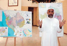
“This is a result of years of careful work,” said Mohamed Al-Mourabet, IT manager and head of Global Information Systems at the SGS. “The individual maps allow overlays of specific mineral resources over a map of the Kingdom. If a company wants a map of a particular resource, we can provide it.”
The information was gathered using remote sensing (satellite imagery) and records previously held by the SGS from field surveys.
Dr. John Roobol, a geologist at the SGS who has been studying the geology of the Kingdom for over 30 years, said the digital database incorporated more than just the location of mineral resources. One of the functions of the SGS, he said, was to provide information for planning major infrastructure projects including environmental, agricultural and urban development.
“The scattered network of seismic sensors is included in the system,” said Hani Zahran of the Saudi Earthquake Center based at the SGS. “In the near future, the networks that have been set up by several different bodies will be integrated and optimized so that the Kingdom will become one of the best monitored — geologically speaking — areas on the planet.”
It was this center that was able to confirm that the recent Makkah earthquake was a very minor and relatively common event. The area is well monitored as it is criss-crossed by a multitude of fault lines resulting in hundreds of seismic events each year.
Most geological information concerning oil and its extraction has been gathered by the main oil companies and is commercially highly sensitive. The new database and its capacity to produce customized maps providing specific information on demand to the public and commercial users however will allow the rationalization of information for business ventures seeking to exploit the Kingdom’s huge mineral wealth and develop a mining and processing infrastructure parallel to the oil economy, for example bauxite and high-quality sand for glass making.
“Saudi Arabia is a very seismically active area, particularly along the Western seaboard,” said Dr. Roobol. “An important part of our work, especially with rapid urban development, is to have accurate data to inform town planners where to build and what level of earthquake-proofing to incorporate in new structures.”