
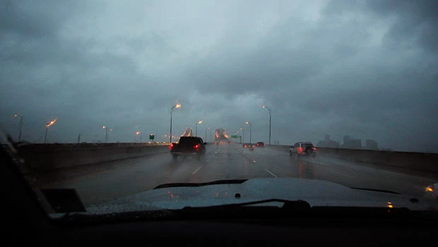
- NEW ORLEANS: Heavy rains from Tropical Storm Lee were falling in southern Louisiana and pelting the Gulf Coast on Saturday as the storm’s center trudged slowly toward land, where businesses were already beginning to suffer on what would normally be a bustling holiday weekend.
- The storm could bring up to 20 inches (50 centimeters) of rain to some areas.
Tropical storm warnings were in effect from Mississippi to Texas, and flash flood warnings extended along the Alabama coast into the Florida Panhandle. The storm’s slow forward movement means that its rain clouds should have more time to disgorge themselves on any cities in their path.
The storm’s biggest impact, so far, has been in the Gulf of Mexico oil fields. About half the Gulf’s normal daily oil production has been cut as rigs were evacuated, though oil prices were down sharply Friday on sour economic news.
Federal authorities said 169 of the 617 staffed production platforms have been evacuated, along with 16 of the 62 drilling rigs. That’s reduced daily production by about 666,000 barrels of oil and 1.7 billion cubic feet of gas.
The storm was expected to make landfall on the central Louisiana coast late Saturday and turn east toward New Orleans, where it would provide the biggest test of rebuilt levees since Hurricane Gustav struck on Labor Day 2008.
Still, residents didn’t expect the tropical storm to live up to the legacy of some of the killer hurricanes that have hit the city.
“It’s a lot of rain. It’s nothing, nothing (compared) to Katrina,” said Malcolm James, 59, a federal investigator in New Orleans who lost his home after levees broke during Katrina in August 2005 and had to be airlifted by helicopter.
“This is mild,” he said. “Things could be worse.”
In New Orleans, sporadic downpours caused some street flooding in low-lying areas early Saturday, but pumps were sucking up the water and sending it into Lake Pontchartrain. Lee’s storm surge so far had not penetrated levees along the coast, National Weather Service forecaster Robert Ricks said.
Tornado warnings were issued overnight in Louisiana and south Mississippi but Ricks said there were no confirmed touchdowns. So far, damage appeared confined to downed power lines and trees.
The outer bands of Lee, the 12th named storm of the Atlantic hurricane season, began dumping rain over southeastern Louisiana, southern Mississippi and Alabama on Friday.
The National Hurricane Center said the center of Lee was about 45 miles (72 kilometers) south of New Iberia and moving north-northwest at 7 mph (11 kph). It was expected to cross the Louisiana coast by Saturday night and pass into the southern portion of the state on Sunday.
Forecasters at the National Hurricane Center say that Lee’s maximum sustained winds had increased to 60 mph (95 kph) Saturday morning. They said some slight strengthening was possible before landfall.
Lee comes less than a week after Hurricane Irene brought destruction to the Caribbean and the US Eastern Seaboard, killing more than 50 people. It was too soon to tell if Hurricane Katia, out in the Atlantic, could endanger the US. It was expected to pass north of the Leeward Islands in the Caribbean.