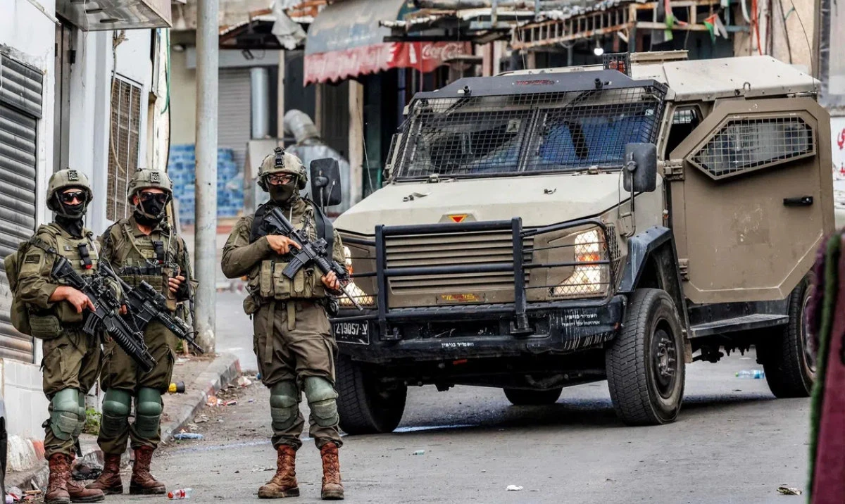
- Strategic high ground overlooking Nabatieh becomes a focus of Israeli military operations amid claims that Hezbollah maintains tunnels and fortified positions beneath the hills
- Analysts say capturing the summits would be easier than controlling the mountainous interior, and warn that Israel may see the heights as leverage in shaping new security order in southern Lebanon
BEIRUT: Rising about 600 meters above southern Lebanon, Ali Al-Taher Heights might appear to be little more than another piece of contested high ground.
But as Israel and Hezbollah edge closer to another potentially dangerous confrontation, the cluster of hills overlooking Nabatieh has emerged as something far more consequential: a military objective, a potential bargaining chip and, perhaps, a test of how far Israel intends to reshape the security landscape north of its border.
Israeli military and political officials have increasingly signaled the possibility of “several days of fighting” in southern Lebanon, with particular attention focused on Ali Al-Taher and the nearby Beaufort Castle area.
Israeli accounts claim that dozens of Hezbollah fighters are entrenched inside underground installations beneath the heights, and Israeli forces are attempting to encircle the area and prevent supplies from reaching them.
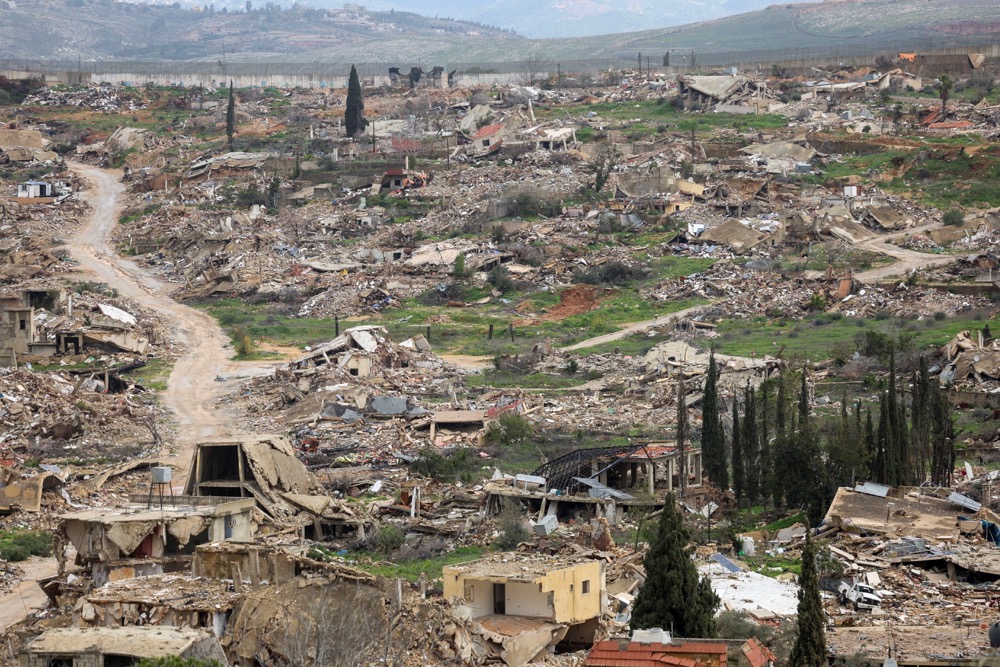
Hezbollah, however, maintains that Israeli forces have failed to penetrate the interior of the hills despite repeated bombardment with heavy munitions, including phosphorus shells.
The competing narratives underline a larger question: Is Israel seeking merely to destroy Hezbollah infrastructure or does it intend to establish a permanent foothold that could become part of a new security reality in southern Lebanon?
That question has taken on greater urgency amid renewed fighting, stalled negotiations and growing concern in Beirut that battlefield gains could eventually be converted into political leverage.
A strategic position above Nabatieh
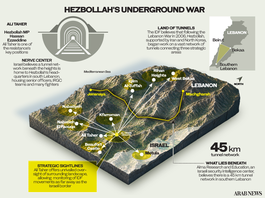
The Ali Al-Taher Heights are in Nabatieh governorate, between Kfar Tebnit and Nabatieh Al-Fawqa, north of the Litani River and about 12-15 kilometers from the Israeli border.
The hills dominate large parts of Nabatieh, Iqlim Al-Tuffah and the Litani basin, granting them strategic importance despite Israel’s overwhelming technological superiority in surveillance and precision targeting.
Retired Brig. Gen. Khalil Gemayel, a former commander of the Lebanese army’s operations in the sector south of the Litani, told Arab News that the area consists of three main hills: Ali Al-Taher, Dabsha and Tuhra. Together they form an approximately 3-kilometer-long ridge that extends from south to north and is about 1.5 kilometers wide.
The western approaches are bordered by Kfar Tebnit, Nabatieh Al-Fawqa, Nabatieh and Kfar Roummane, while the eastern side is less densely populated.
“It is believed that the tunnels the Israeli army is talking about are located in that area,” Gemayel said.
The heights were among the last positions vacated by Israeli forces when they withdrew from southern Lebanon in 2000.
Their importance, Gemayel said, lies in the fact that they overlook Nabatieh and surrounding villages, as well as eastern approaches toward Jezzine.
“It is believed that these hills form Hezbollah’s southern central command headquarters,” he added.
Israeli forces are currently operating along the ridgelines and control the top of Ali Al-Taher Hill, Gemayel said, adding that they have reached Dabsha but have yet to penetrate deeper into the terrain.
“The Israeli army tries to advance and provoke battles, but quickly stops because of the cost involved,” he added. “It therefore relies on reconnaissance robots. What we know is that the Israeli army is opening military roads and building fortifications along the ridgelines.”
The underground dimension
Much of Israel’s attention has focused on what it says lies beneath the hills. “Imad 4” has featured in Israeli reporting as the name of one of Hezbollah’s most heavily fortified underground installations in the area.
During the previous war, Hezbollah released footage showing a large underground military facility, although it did not disclose its location. Israeli accounts have described parts of the network as an “underground city.”
A source familiar with Hezbollah told Arab News that the group does have a military presence in the Ali Al-Taher area but declined to confirm Israel’s description of what lies beneath the hills.
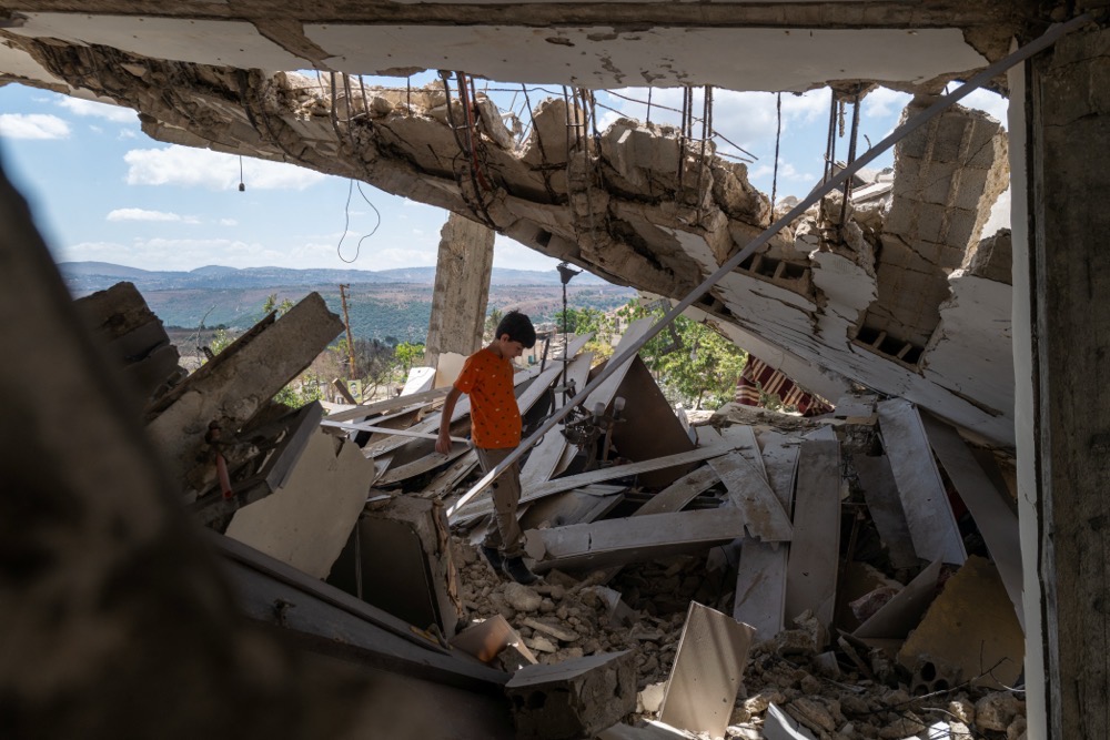
“If Israel had precise intelligence about what it claims is there, it would have taken control of these hills rather than simply bombing them and pushing the Lebanese army to enter the area,” the source said.
Hezbollah also categorically rejects handing the heights over to the Lebanese army, as Israel has demanded, the source added.
From Hezbollah’s perspective, doing so would amount to accepting the surrender of its weapons north of the Litani River, a precedent it fears could lead to further Israeli demands elsewhere.
That makes Ali Al-Taher more than simply a battlefield; it is becoming a test of whether military pressure can alter the political and security arrangements governing southern Lebanon.
A stalled diplomatic track
Israel’s advance deeper into southern Lebanon halted near Beaufort Castle during clashes on March 2. A temporary ceasefire followed direct talks between Lebanon and Israel held under US mediation on April 14.
According to a Lebanese military source, the ceasefire prevented Israel from completing what was believed to be a plan to advance toward Nabatieh, encircle Ali Al-Taher and capture the heights. Beaufort Castle lies only about 3-4 kilometers from the area.
Seven rounds of direct Lebanese-Israeli negotiations followed, first in Washington and later in Rome. Yet Israeli ground and air operations continued across southern Lebanon and, at times, extended to Beirut and the Bekaa Valley.
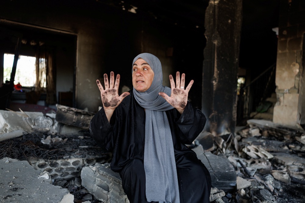
The escalation intensified last weekend after three Israeli soldiers were seriously wounded in the Ali Al-Taher area in what Israel said was a drone attack. Hezbollah did not claim responsibility.
Israel responded with a wave of strikes that, according to Lebanon’s Ministry of Public Health, killed 11 people, including women and children.
Israeli newspaper Yedioth Ahronoth, citing military sources, reported that any wider operation against the heights would require authorization from Israel’s political leadership and Prime Minister Benjamin Netanyahu.
In Beirut, meanwhile, information is circulating that Lebanese officials were told by Washington the US cannot entirely prevent Israel from acting but is seeking to ensure any operation remains limited and focused, reduce civilian casualties, and preserve the existing negotiating framework.
Why technology is not enough
Ali Al-Taher’s importance highlights an apparent contradiction. Israel possesses satellites, drones, electronic surveillance systems, fighter aircraft and precision-guided weapons capable of monitoring and striking targets across Lebanon. Why, then, would it need to physically control a series of hills?
Retired Brig. Gen. Munir Shehadeh, a former president of Lebanon’s Military Court and former commander of the Military Police in southern Lebanon, said the answer lies in the difference between observing territory and owning it.
“The importance of Ali Al-Taher is not that Israel needs the hill in order to see or strike targets,” he told Arab News. “Israel has satellites, drones, electronic reconnaissance, combat aircraft and precision weapons.
“The real importance is that holding the high ground gives Israel something technology alone cannot provide: a permanent physical presence inside Lebanese geography.”
Control of the heights would provide Israel with better observation of movement around Nabatieh, Iqlim Al-Tuffah and Jabal Al-Rihan, while also allowing it to deploy ground-based surveillance and communications systems.
More significantly, Shehadeh added, it could provide added depth to whatever security zone Israel is seeking to establish. It could also carry domestic political value in Israel.
“Control of the hills is a negotiating and political card because whoever controls the high ground can turn military control into a fait accompli,” he said.
“Israel’s insistence on Ali Al-Taher, despite possessing all this technology, confirms that the issue is not only about destroying Hezbollah’s capabilities from the air; it is also about controlling territory.”
Taking the summit is not taking the mountain
Israel has previously included Ali Al-Taher Heights on maps within what it describes as the “yellow zone” under its control. Yet fighting and bombardments continued even after Israel said it had taken parts of the heights.
Shehadeh said this illustrates the crucial distinction between controlling the top of a hill and controlling the entire terrain beneath and around it.
“There is a fundamental difference between Israel knowing what is in an area and being able to strike it, and Israel being able to enter the area, control it, remain there and prevent the adversary from operating inside it,” he said.
Israeli surveillance and airpower can expose and destroy individual targets. But ground forces entering mountainous terrain face a different set of challenges: tunnels, shelters, steep slopes, restricted approaches, dead ground and concealed fighters.
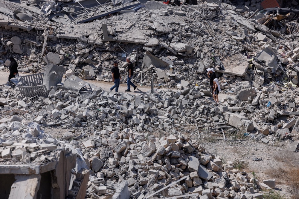
“Technology reduces the difficulty of an offensive battle but it does not eliminate the problem of occupation and sustained control,” Shehadeh said.
A mountain, he added, cannot be understood simply as a summit: “A hill is not a single geometric point. It is a system of summits, slopes, valleys, mountain shoulders, access roads, dead ground and geographical depth.”
He distinguished between three levels of control. Fire control means being able to strike the area and restrict movement. Summit control means physically occupying the highest positions.
However, controlling the depth means securing the entire mountain mass and preventing Hezbollah from returning, infiltrating or rebuilding its infrastructure.
“That third level is the most difficult,” Shehadeh said.
The cost of going deeper
Militarily, Israel could attempt to penetrate deeper into the heights, Shehadeh said. But doing so would transform the operation from a campaign of targeting into one of occupation and security.
“If the Israeli army enters the depth, it moves from a battle of targeting to a battle of control and security,” he said.
“The more it expands its deployment, the greater its need to secure roads, protect troops, cover its flanks, and prevent infiltration or the rebuilding of military infrastructure.”
This creates a difficult strategic choice. Israel can seek to hold the ridgelines and dominate the area with firepower, or commit larger numbers of ground troops and accept the costs and risks of securing a wider zone.
The latter option could carry significant military and political consequences. It could also indicate that the Israeli objective extends beyond simply weakening Hezbollah.
A bargaining chip for a new security reality?
Shehadeh believes Israel’s more consequential goal might not be to occupy Nabatieh itself. Instead, it could seek to establish control over elevated positions surrounding the city, leaving Nabatieh under observation and military pressure without requiring Israeli forces to enter the urban center.
“The repeated operations around Ali Al-Taher Heights, alongside Israeli talk of creating a new security reality, should not be read solely as an operation against Hezbollah,” he said.
“Israel announced that it had imposed a new security reality in the area after declaring control of the hills, while shelling and clashes continued afterward.
“That carries an important political message: Israel does not only want to prevent Hezbollah from being present in this area, it wants its own presence there to become part of the new security equation.”
That possibility goes to the heart of the dispute over Ali Al-Taher. Is Israel seeking a temporary tactical advantage before eventually withdrawing? Or does it see the heights as an anchor for a more permanent security belt inside Lebanese territory?
Current battlefield behavior means the second possibility cannot be dismissed, Shehadeh said, particularly as the military escalation continues despite the diplomatic track.
At the same time, Hezbollah continues to reject disarmament, refuses to recognize the direct negotiations between Lebanon and Israel, and opposes any moves that would mean handing over its positions in Ali Al-Taher to the Lebanese army.
That leaves the heights caught between two competing strategies: Israel’s attempt to impose a new security reality through military pressure, and Hezbollah’s efforts to prevent any precedent that would weaken its position north of the Litani.
What happens next could therefore matter far beyond the three hills overlooking Nabatieh. Ali Al-Taher might become the place where the limits of Israeli military superiority, Hezbollah’s determination to retain its weapons, and the viability of the diplomatic process are tested all at once.
And if that test fails, the question will no longer be who controls the heights — but whether they become the trigger for a much wider war.