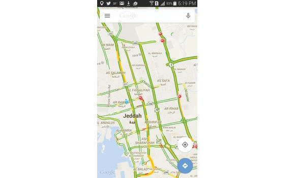
Google Maps has become a source of considerable help for motorists wishing to avoid the highly crowded roads in Jeddah. Recently, it has been helping them to choose the the least busy roads to use in order to reach their destination.
The most crowded of streets witnessing the highest level of traffic incidents on weekdays is Haramain Road, where work on the railway project is under way, especially between the Jamia overpass and the Airport Bridge.
Other streets that experience frequent heavy delays include Prince Majed Road and King Fahd Road up to the Rowda intersection on the Madinah Road side, as well as occasionally on King Abdul Aziz Road, Falah Road and Television Street. On Palestine Street, the area between Prince Miteb Road and King Abdul Aziz Road intersection also experience bottlenecks, while Prince Muhammad Road between Makarona Road and Madinah Road and between the Prince Fawaz Southern Project and Makkah Road also experience delays. Further, Abdullah Sulaiman Road in the Old Airport area also has very frequent traffic bottlenecks.
It has been noted over the past few days that the bulk of the traffic congestion has shifted from the east of Jeddah to the middle of the city as motorists try to avoid crossing the busy Haramain Road and try to utilize less busy roads such as Madinah Road, Prince Majed Road and King Abdulaziz Road.
Traffic jams are relatively less frequent at the roundabouts at White Horse, Bicylce, Sitteen, Palestine, Mustaqbil, Prince Sultan and on Abdul Aziz bin Baz Street.
Jeddah Traffic Director Maj. Gen. Wasalallah Al-Harby has urged motorists to try using less crowded roads such as Prince Miteb Road, Makarona Road, Umm Al-Qura Road and several other roads that run south to north in the city.
Google Maps a relief for Jeddah motorists